(37k)
(37k)
(click on any picture for a larger version; click your browser's back button to return and continue reading)
We traveled to northern New Mexico in late May 2002 with the intent on exploring the Burlington Norther Santa Fe Railroad between Raton and Alburquerque. We were very successful, and enjoyed our trip. The thing that interested us about this railroad is the semaphore signalling system.
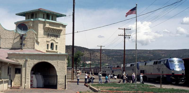
The day after we arrived at Raton, we left our trailer in the Raton KOA, and explored the hill between Raton and Trinidad, Colorado. We we returned the next day, and took pictures of Amtrak's westbound Southwest Chief at Wooton, Colorado, and also at the Raton depot.
 (79k) |
 (43k) |
We returned to the campground to pick up our camper, and the rest of the day was spent photographing the semaphores between Raton and Las Vegas.

(63k)
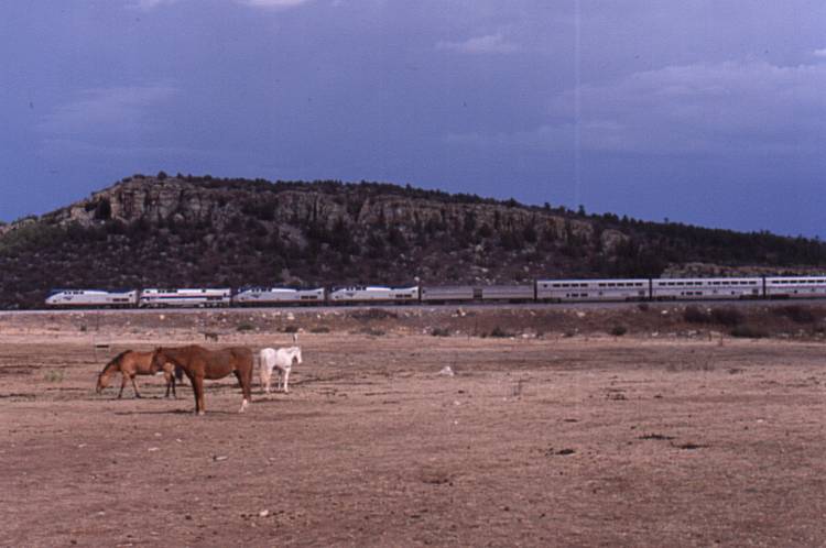
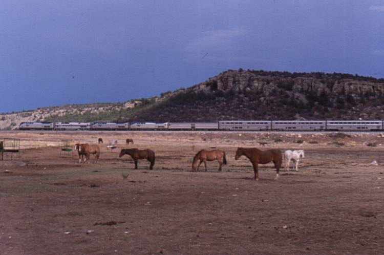
We found a particularly nice spot to photograph a train at Valmora, NM. Since there are very few trains on this route, we decided this was the best spot to wait for a train.
|
|
We waited about 2 hours for Amtrak's eastbound Southwest Chief to show up. While we were waiting, one person stopped to ask if we were lost; we said no, we are just waiting to photograph the train. A second person stopped, and asked if we needed any help, I again explained that we were just waiting to photograph the train. She explained that Valmora is a boys school (reform school?), and that she would be telling the persons in charge what we were doing. I asked if we should leave, and she said that it would be OK to stay. I thanked her, and we heard nothing more about this from anyone.
We spent the night at the Las Vegas KOA (No silly, not that Vegas!)
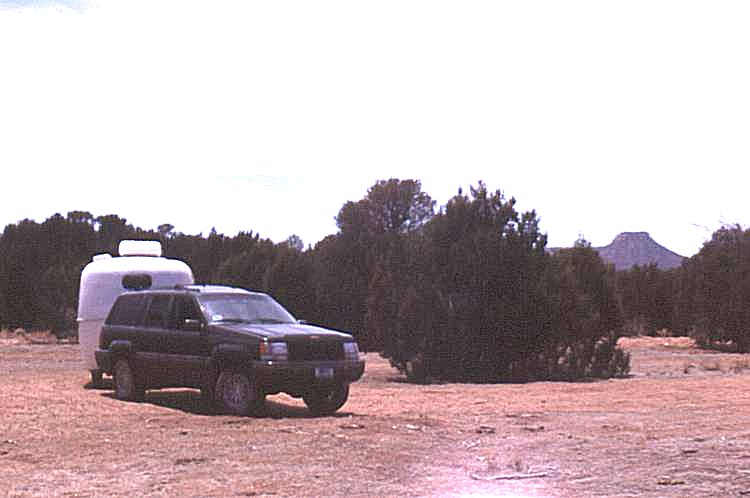
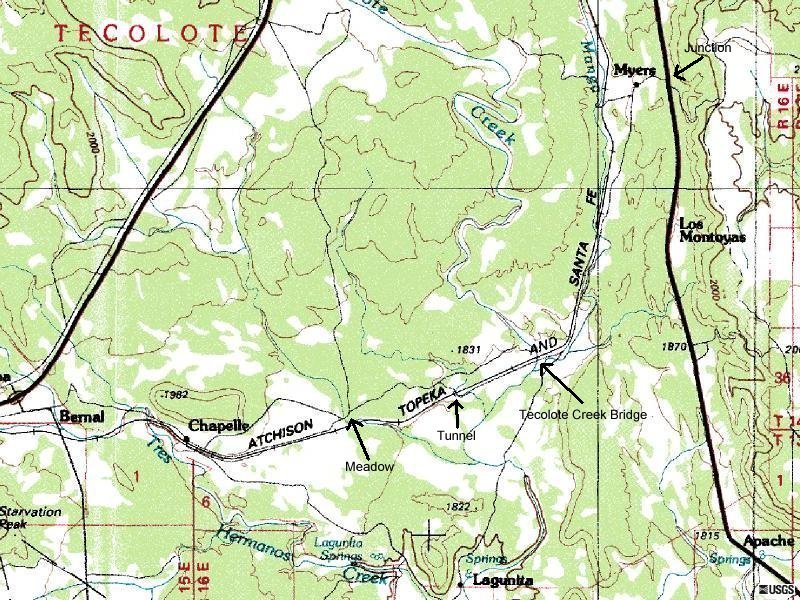
The next day we chased the rail line from the junction of US 84 and the County Road 5-6 miles south of the junction of Interstate 25, south and west to Chapelle, NM. It turned into a mini off-road adventure; it is probably also where we damaged our right-front tire. We found the tire quite low on air a couple days later, and had it patched up. Click for a map of our route. (188k)

(57k)
The road was not too bad to this wash, known as Tecolote Creek, and is about 3.5 miles from US 85. This was an interesting location - the road simply led down to the dry stream bed, and crossed on the bedrock that has been scoured clean.
From here, the condition of the road was very poor. The road narrowed and went down a steep grade. Before going down the grade, we stopped and walked ahead to be sure the road was stable, and we could turn around ahead if need be. Checking the road on foot slowed our progress considerably. We put the Jeep into low range, and forged ahead.

(61k)
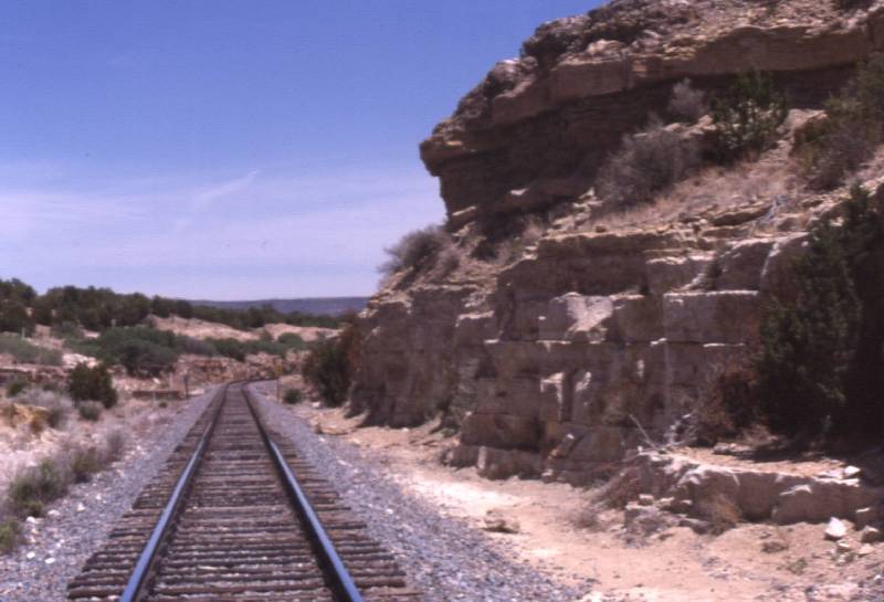
This tunnel was neat. It was about 4 miles from US 85. We stopped here to take pictures and walk ahead to make sure we could turn around. It was clear that passage was possible, but it was also clear we would need to explore another quarter-mile down the road once we arrived at the other side of the tunnel. The road got even narrower, more rock-strewn, hilly and pot-holed.
|
This photograph was taken along the way. Some parts of the path were even worse than this! |
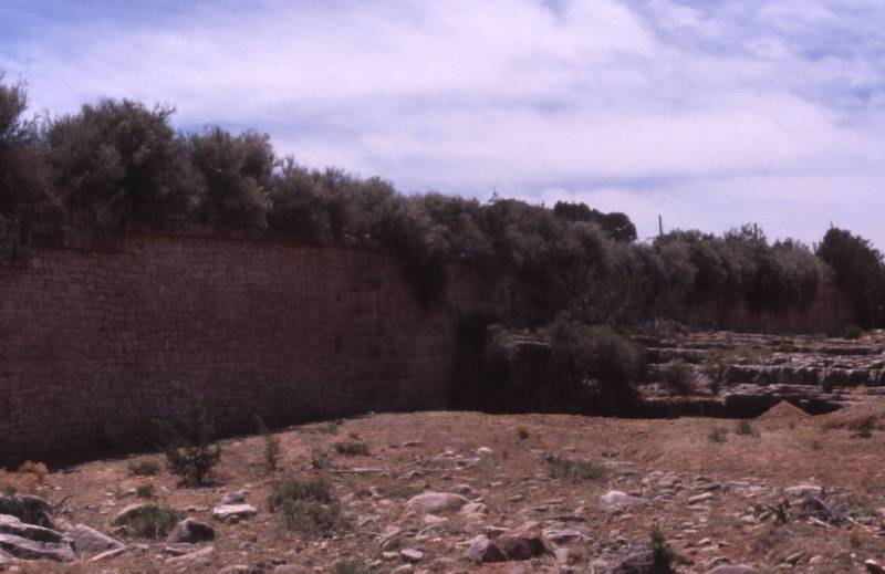
This location was down a side road at about mile 5.5. We walked from here to the railroad, crossing a dry creek bed. There was some very nice stone work protecting the railroad from water running in this creek. |
|
|
|
|
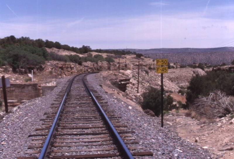
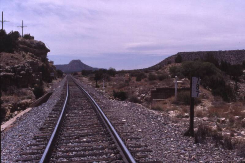 If you turn around and look west, you see that we are at railroad milepost 787 (53k) |
 If you climb down from the railroad, this is what the bridge looks like from the creek. (61k) |
We called Amtrak to find out how far behind schedule Amtrak was, and decided we should find a nice spot to photograph the train. We found a place called Chapelle.
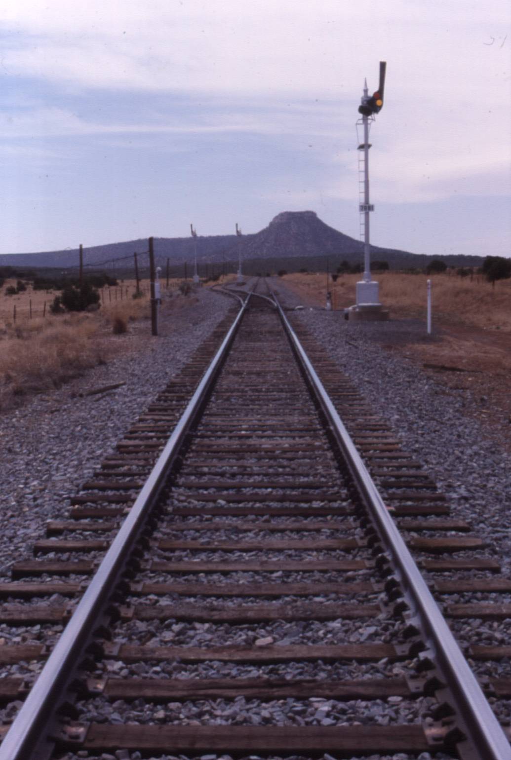 Three semaphore signals, and scenic Starvation Peak in the background |
 We parked our Scamp travel trailer on the side of the road, and ate lunch while waiting for the train. Here is Amtrak's Eastbound Southwest Chief taking the siding for it's westbound counterpart. |
The westbound train came and went (I did not get any pictures, but I think Dawn did...).  The train was having mechanical trouble with an air line between locomotives. The crew attempted to change the hose, but without success. |
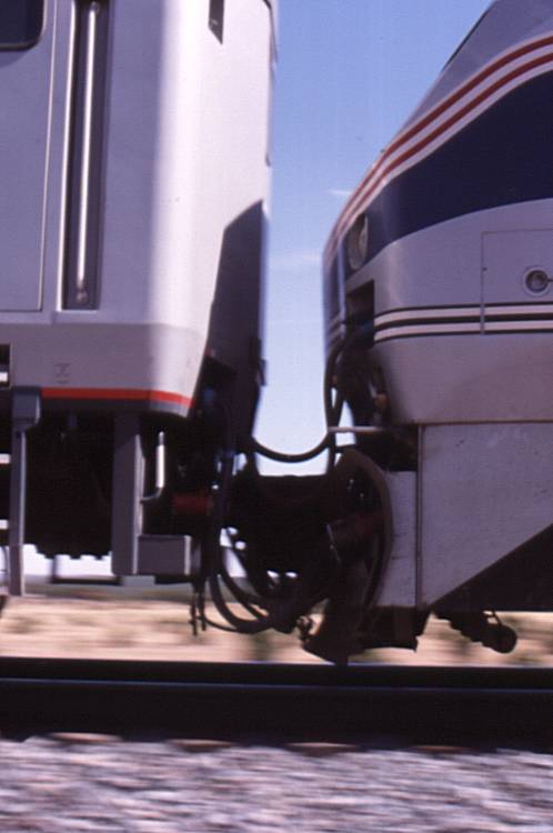 One of these hoses are leaking. |
There goes one of the longest Amtrak trains running on Amtrak's network.  This train has 5 locomotives, a baggage car, a crew dormitory car, 3 sleeping cars, diner, lounge 4 coaches, 8 boxcars and 4 road-railer trailers. |
While I was standing there waiting for the train, I heard and saw several military delta-winged aircraft fly overhead. I took a picture, but my slide scanner can't pick up that the speck in the picture is an airplane.
At the conclusion of this days adventure, we drove to the Santa Fe KOA campground for some rest.
v20060408a drm
copyright Daniel Meyer 2006. All rights reserved. Please contact me for permission to use any content in any way.

